local nuance
Housing to Break Down Invisible Boundaries
The urban environment is a tangle of invisible infrastructure that choreographs where and how people live, who they are represented by, and many aspects of life in general. “Local Nuance,” a second semester graduate studio proposal, creates an architectural intervention through the typology of a ‘wall’. Operating physically within but politically against geopolitical boundaries, the nuances of hyper-localized living conditions thrive at three scales: the urban, the neighborhood, and the dwelling. Housing constructed in this manner brings together neighbors not based on their income, age, sociopolitical status, or race, but rather on the notion that difference does not require division.
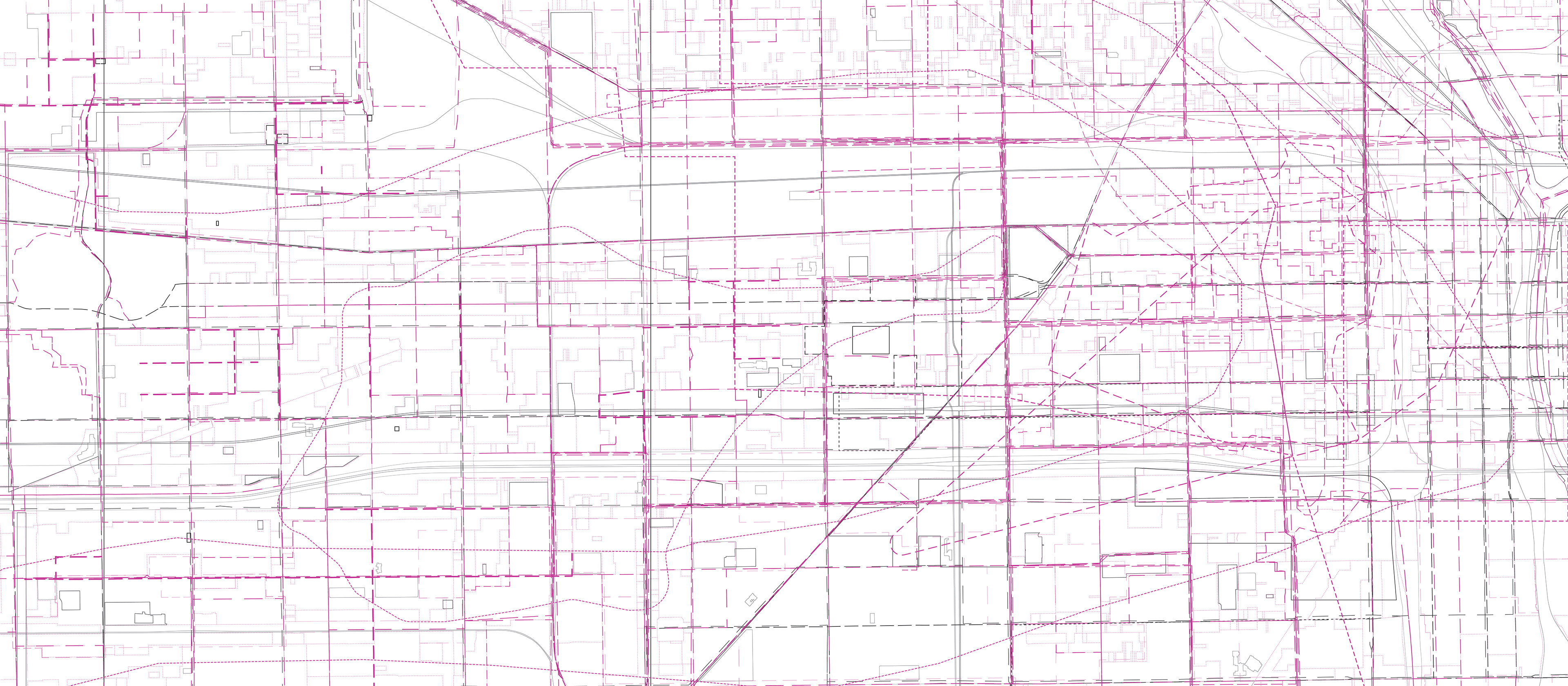

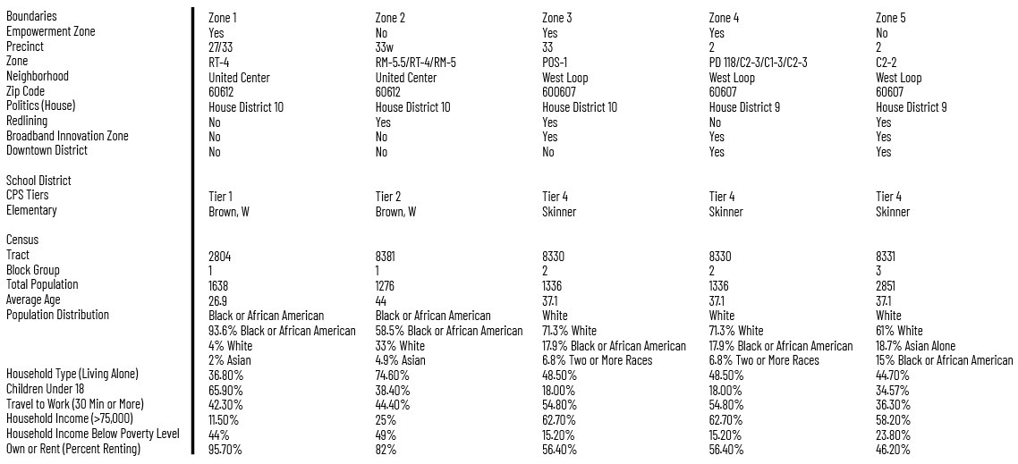
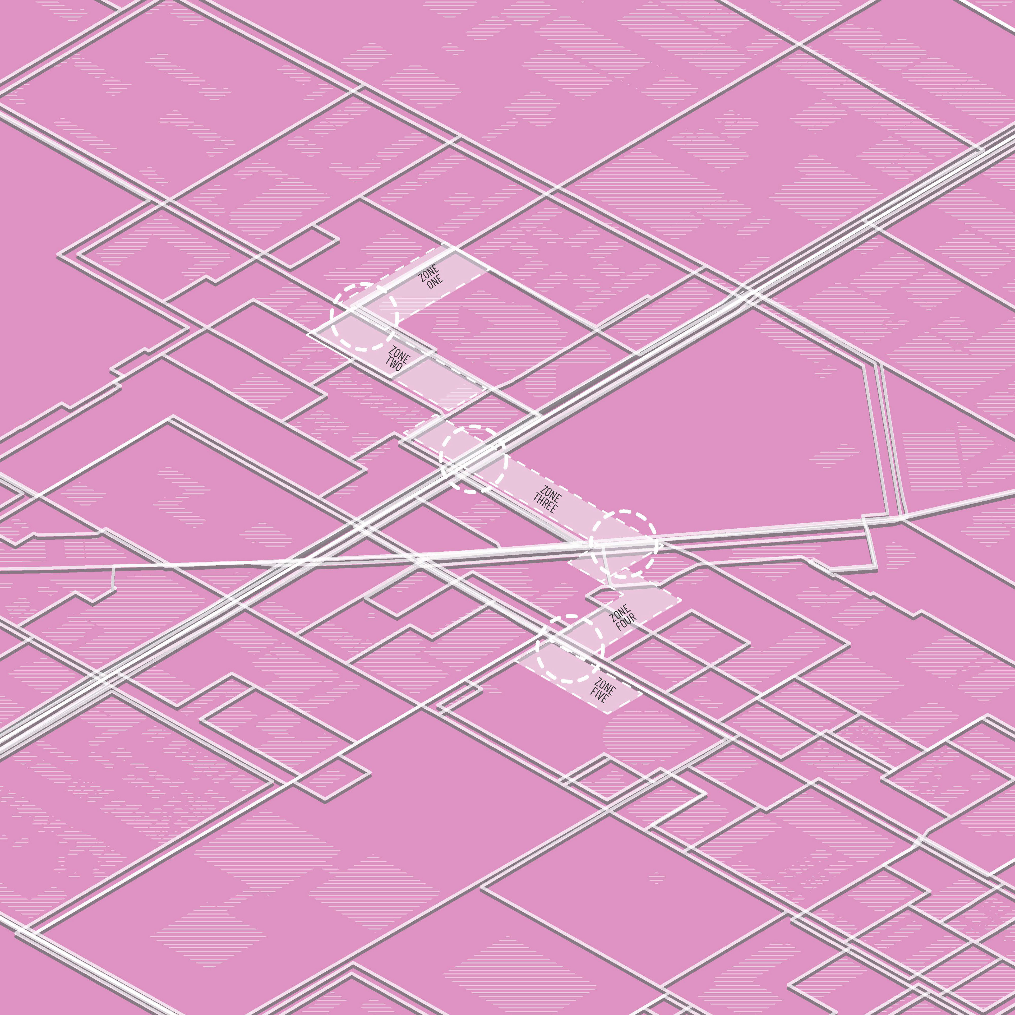
Geopolitical boundaries divide the site into five distinct zones. These zones are separated by the edges of the data sets that outline 22 opportunities for difference.
Boundaries follow urban transportation infrastructure.
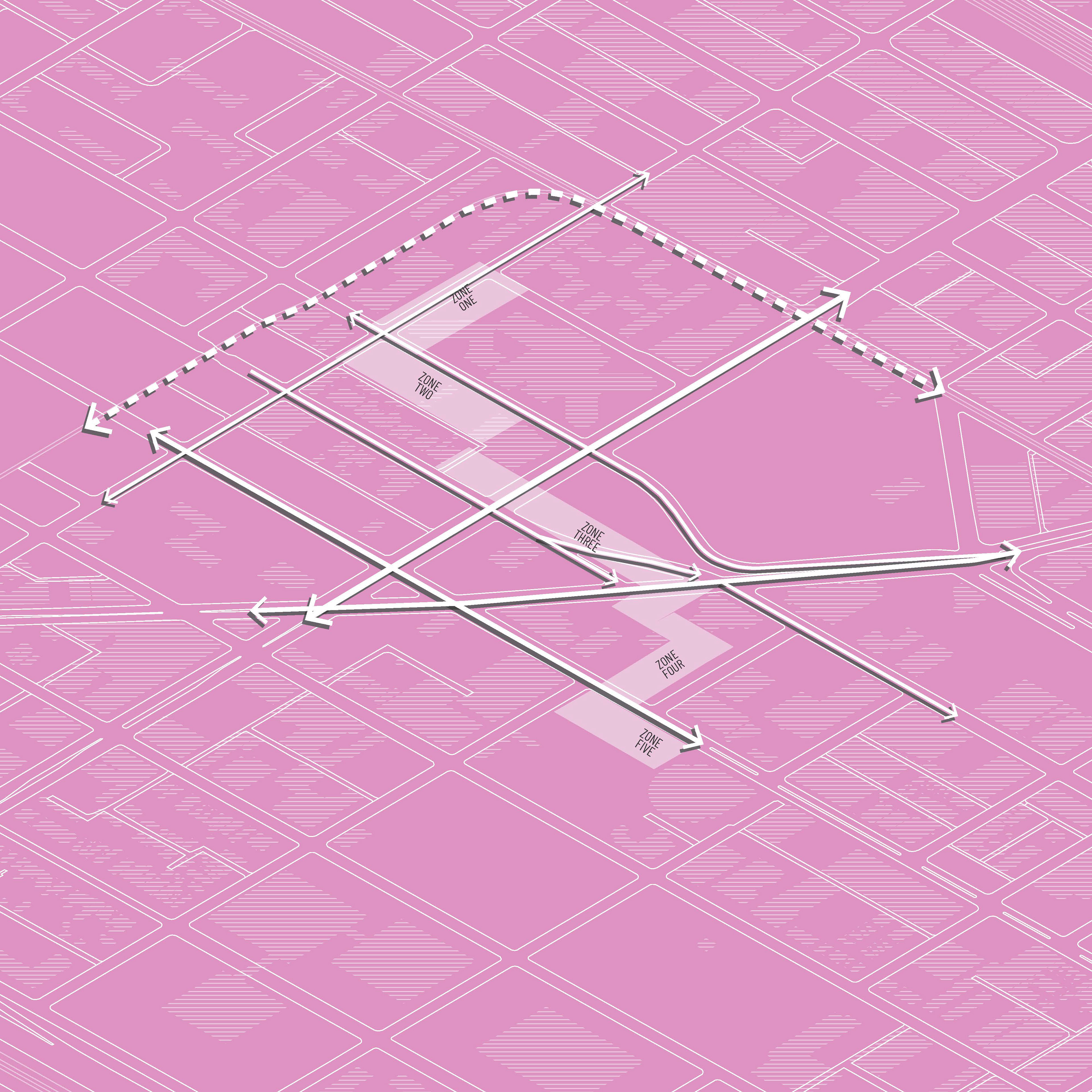
Boundaries follow urban transportation infrastructure as major transportation routes cut through the site.
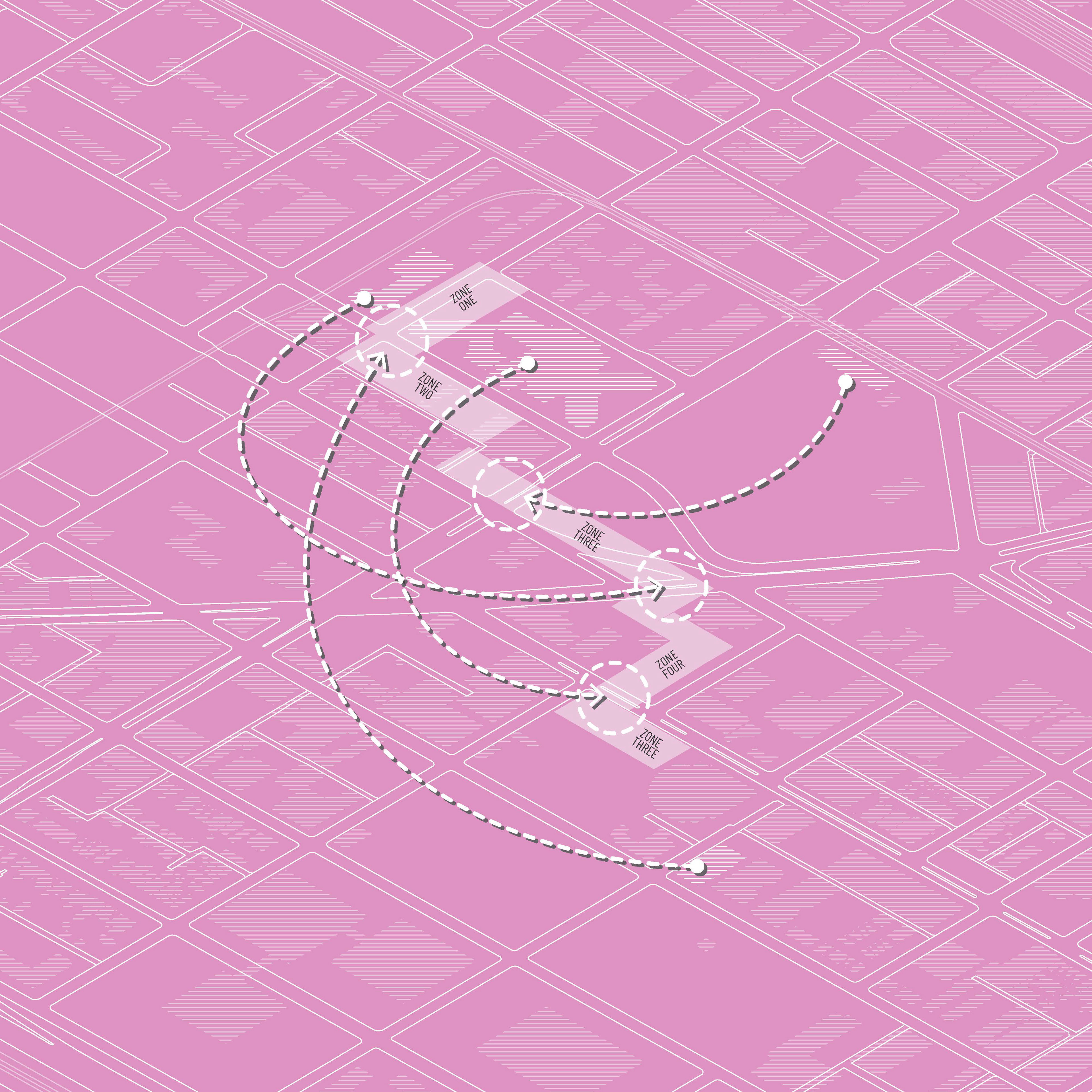
Existing programs are mirrored and revitalized on the opposite sides of the barriers.
In his essay Boundaries / Networks, William J. Mitchell argues that society relies upon the interconnected network of barriers and boundaries that were historically manifested as a “circle of walls.”[1] While modern metropolises are praised for openness and accessibility, Chicago, while not physically contained by a wall, is unquestionably a site of boundaries as decisive mechanisms of political geography.
Conducting research on these divisions, a map celebrating the permanence and temporality of the city was created to illustrate the landscape constructed of invisible walls that provide both opportunities and limitations to those on either side. Examples of boundaries present in Chicago’s infrastructural facade include empowerment zones, tax increment financing areas, Chicago Public School tiers, and historic redlining. These zones claim to respectively “Stimulate comprehensive renewal… in distressed urban neighborhoods and rural areas,”[2] “Promote public and private investment across the city,”[3] “Place every part of the city into one of four socio-economic ‘tiers’... imparting a student’s chance of getting into the city’s top schools depend[ing] on where he or she lives,”[4] and “Color-code credit worthiness and risk.”[5] Due to these strategies of urban dissection, boundaries produce over-generalizations of diverse people groups. “Local Nuance” rejects these simplifications to celebrate the subtleties of individual lived experiences at three scales.
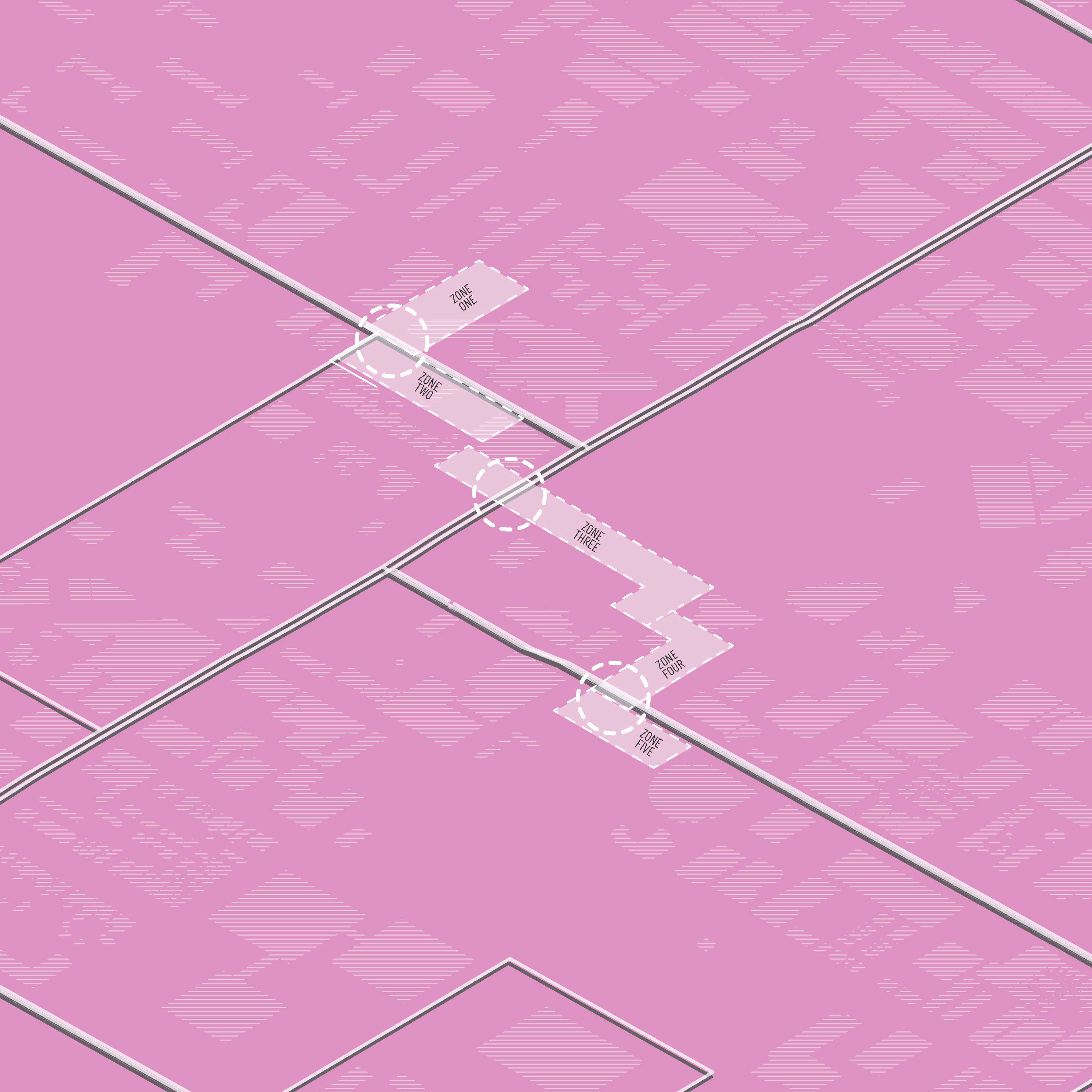
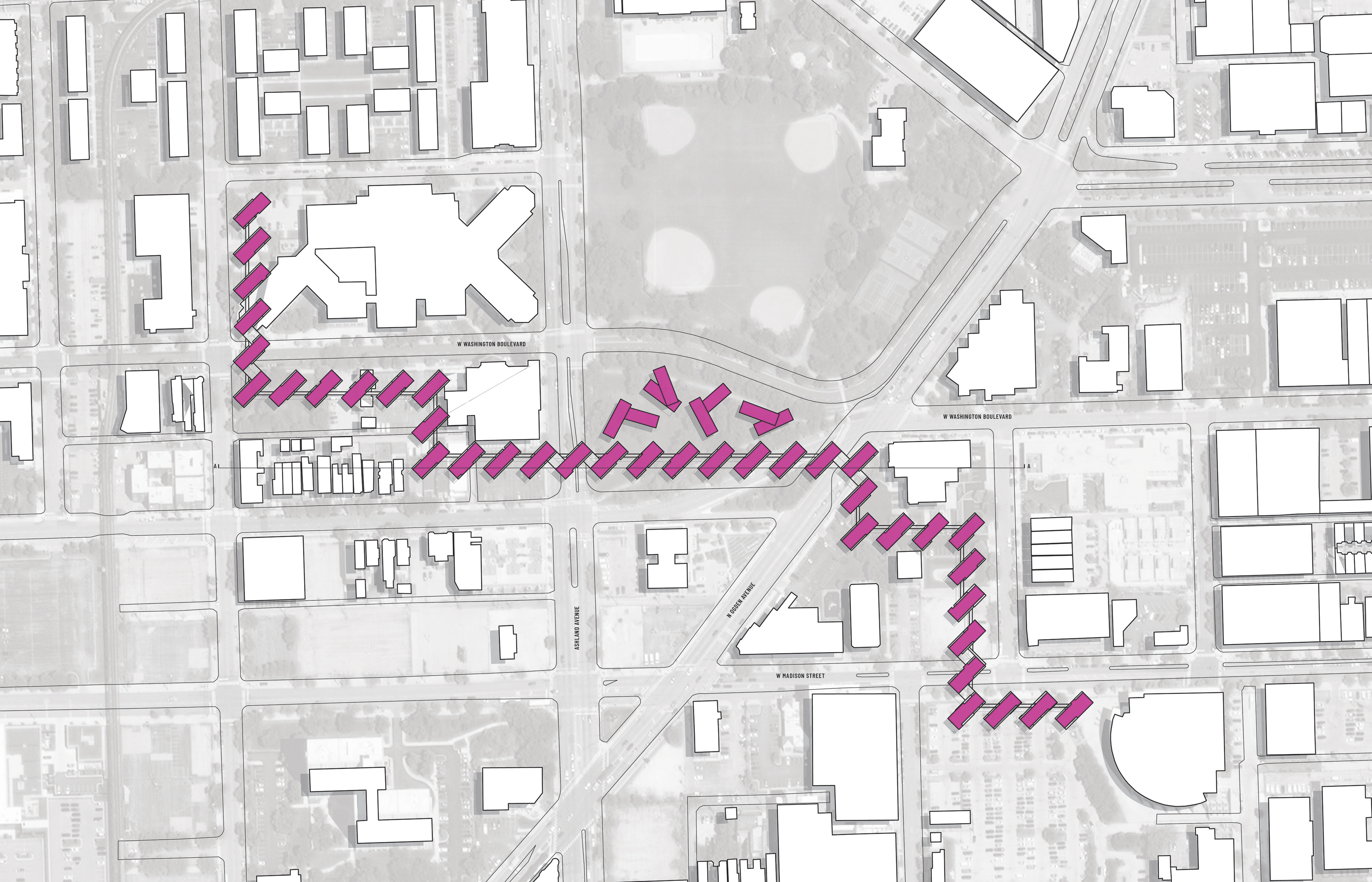
At an urban scale the separate dwelling structures are located along either side of invisible barriers traversing 3 square blocks, 4 census block groups, 11 different civic divisions, and over 2,600 linear feet. These conditions author a union of various populations by traversing the boundaries that are commonly used as points for separation, limitation, and segregation and creating a space for community and connection.
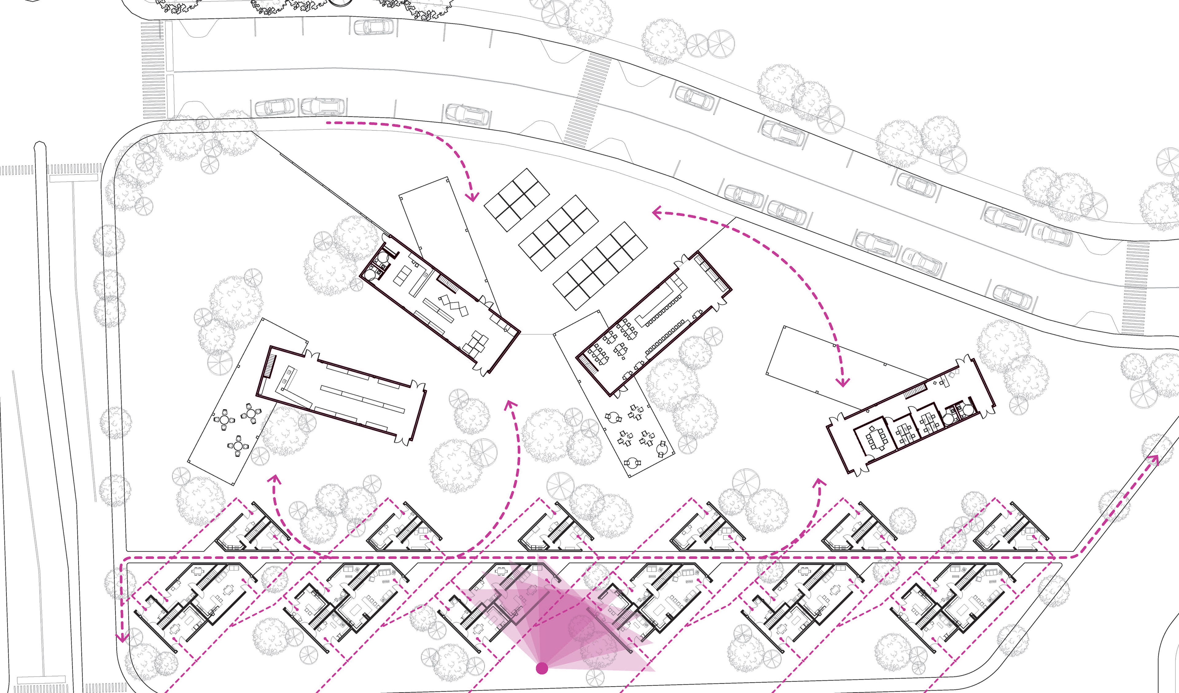
Residential interaction through the shared urban environment as public space as opposed to privately owned separations of house and home occurs at the scale of the neighborhood. Each of the residential structures rotate at a 45 degree angle creating a visual wall from a straight on standpoint but that physically opens as you move along the street. Permeability is thus established between civic barriers. The rotation allows for each structure to receive natural light on all four sides activating the streetscape and the “side” and “back” yards welcoming what otherwise might be isolated.
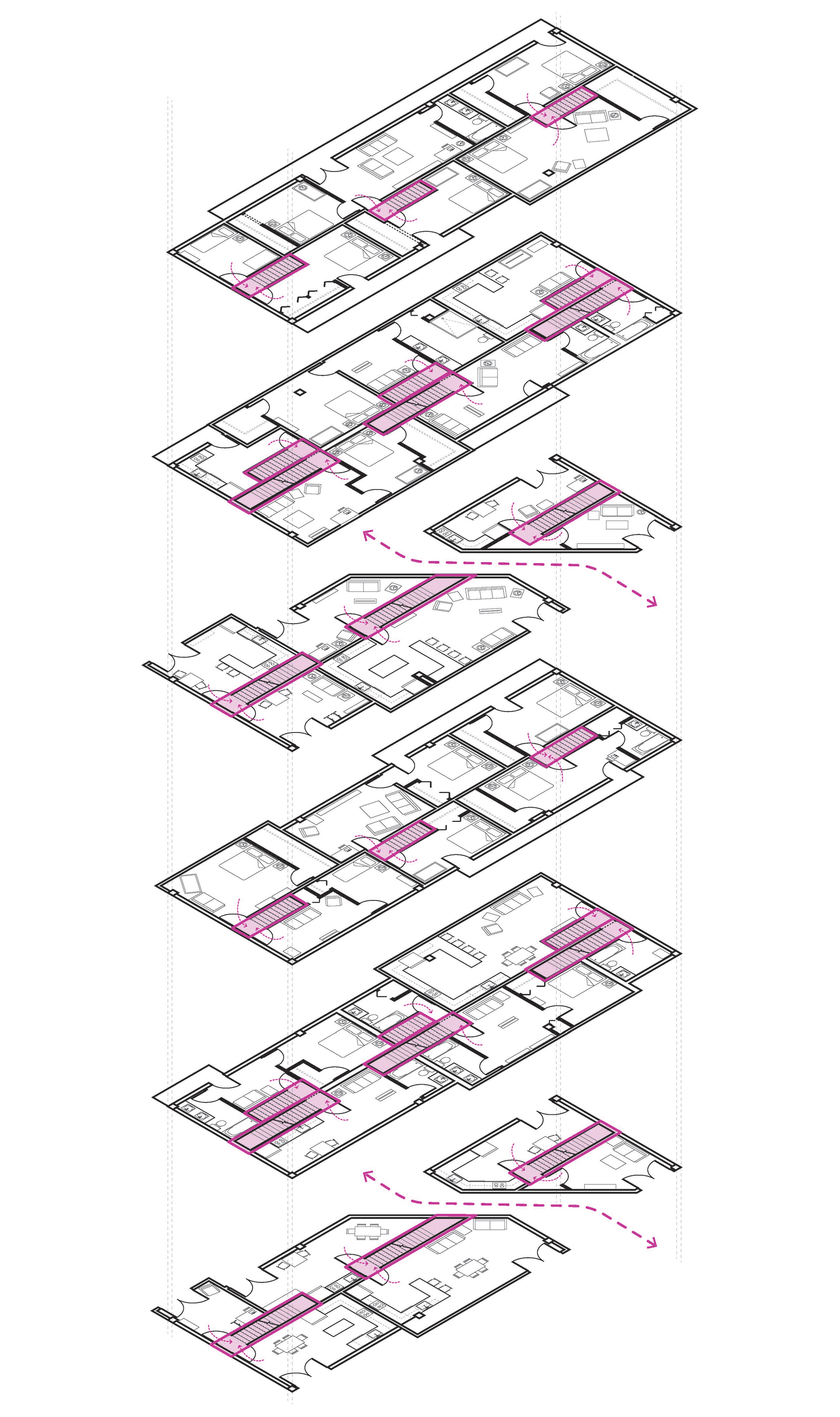
Over-generalizations continue to be broken down at the scale of the dwelling as the demising wall no longer acts as separation but shared volume. Staircases flip across the central axis allowing for optimal daylight and neighborly interactions. Residential entries located on the first floor activate the exterior as units expand vertically instead of laterally based upon the dimensions of a standard Chicago greystone townhome. Shared balcony spaces provide access for interaction at points above the standard patio. The subtleties of these alterations to the standard living space layout minimize the impact of boundaries within the home.
If cities are to rely on the network of boundaries suggested by Mitchell, how might architects and designers today puncture and operate along, against, and through the mandated maintenance of systematic division? “Local Nuance” is a scalable framework operating within instead of around these municipal partitions, providing opportunities to privilege difference.
1. Mitchell, William J. Me : The Cyborg Self and the Networked City. Cambridge, MA: MIT Press, 2003. Pg. 228-245
2. “Innovation and Technology.” City of Chicago:: Chicago History. Accessed May 10, 2018. https://www.cityofchicago.org/city/en/depts/doit/dataset/boundaries_-_empowermentzones.html.
3. “Planning and Development.” City of Chicago :: Chicago History. Accessed May 10, 2018. https://www.cityofchicago.org/city/en/depts/dcd/provdrs/tif.html.
4. City, Open. “About.” Chicago Public School Tiers. Accessed May 10, 2018. http://cpstiers.opencityapps.org/about.html#the-tier-system.
5. Digital Scholarship Lab. “Mapping Inequality.” Digital Scholarship Lab. Accessed May 10, 2018. https://dsl.richmond.edu/panorama/redlining/#loc=13/41.8690/-87.6797&opacity=0.8&area=D33&sort=45&city=chicago-il&text=intro.